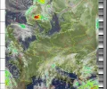
My go at WXSAT

I live down a north facing hill which dose not help.On a lot of passes my house and others on the street block the satellite at the start of northbound passes.I do get good scans on some northbound passes.Re the start stop elevation settings I have tried 0 to 20 it is set at 15 most of the time.The best solution would be to put the antenna on the roof of the house that is not going to happen though.I had enough trouble from Mrs Ponti when I had a dish on the front of the house.I would have no chance of getting a antenna on the roof.All that said I cannot complain I do get a lot of good scans.It all depends on the orbit of the pass.
 
Last edited:
A nice southbound one this morning.
noaa 19 42 W MEL 13 W LONG 06:11 southbound
Edit it looks like rain up in the borders.:)
noaa-19-12130611-mcir-precip.webp
 

Attachments

  • noaa-19-12130611-norm.webp
    noaa-19-12130611-norm.webp
    29.1 KB · Views: 3
I have been getting a lot of poor scans recently.I suspected that damp had got into the antenna or the cable joint near the pole.I took it down checked the cable reinstalled everything this afternoon.This is the first scan after reinstall.Quite a good one.
It is possible that It is just a lucky pass between the houses I will see what happens with less favorable passes.If nothing else I know that the equipment is working properly.Next up I need to find out why Cubesats are proving difficult to get.:)
N19 87 MEL 2 W 1544.
noaa-19-01011544-mcir-precip.webp
 

Attachments

  • noaa-19-01011544-norm.webp
    noaa-19-01011544-norm.webp
    35.5 KB · Views: 2
I redid the discone/mobile antenna connections, then replaced the cable run as a precaution , but nothing helped at this location. My first scan was the best, with the 6" antenna supplied with another dongle for DVB reception, so I suspect the laptop I have running the programme(s) is not wxsat friendly, since the audio from the satellites caomes through loud and clear and the pulsing can be seen on the waterfall for the whole duration of the pass.

I'll try again soon, has anyone tried this using something other than a Windows o/s ?
 
Its certainly possible to use either rasp pi's or linux computers to do the decoding - instructions for both can be found on YT
 
Thanks, I have a reasonably modern tower here doing absolutely nothing (not forgetting a functional Macintosh G4 that I use as a footrest), the drives were set up for XP but I have been looking for a freebie Win 7 towards the end of 2018, the wife took the one I had for her own work.
 
Build a machine with a 64 bit win7 home premium iso & I'll send you a pukka key for it.
 
The houses still get in the way on some scans.Some are good this one is ok.Two images saved.contrastb and mcir-precip
I think that it was a 24 West pass.
NOAA18 2105
noaa-18-01032105-contrastb.webp
noaa-18-01032105-mcir-precip.webp
 

Attachments

  • noaa-18-01032105-norm.webp
    noaa-18-01032105-norm.webp
    20.7 KB · Views: 1
The houses still get in the way on some scans.Some are good this one is ok.Two images saved.contrastb and mcir-precip
I think that it was a 24 West pass.
NOAA18 2105
View attachment 121969
View attachment 121970
I still have a few cases of ********(big boom boom stuff, done this way as to not attract the NSA) left over from doing a foundation.
 
Ive found the land was getting offset from the map outlines:

offset.webp


If you find this happening to you make sure the computer clock is set to regularly synched to an ntp source - I think the non synched one on mine had drifted allowing the data to be incorrectly set in wxtoimg.

I can provide an easy how to if anyone thinks it would be useful.
 
I still have a few cases of ********(big boom boom stuff, done this way as to not attract the NSA) left over from doing a foundation.
You have lost me there Terryl.You must remember that you are talking to an old fogey trying to keep up .Though I am a just bit younger than you.:rolleyes:
 
You have lost me there Terryl.You must remember that you are talking to an old fogey trying to keep up .Though I am a just bit younger than you.:rolleyes:
July02.gif Big boom boom stuff........
 
I got a very clean one this morning.Not blown any houses up either :-)
nooa 15 31 E MEL 14 E LONG Southbound
noaa-15-01190633-31 e 14 e.webp
 

Attachments

  • noaa-15-01190633-norm.webp
    noaa-15-01190633-norm.webp
    28.8 KB · Views: 3
I have said elsewhere that I have been getting some poor scans in the west.I thought perhaps it was due to the ash trees to the west that may be part of the the problem.However I have also been getting some bad ones from some East scans.
A rethink is required.I think that I have probably got the wrong end of the stick with the meaning off MEL ( maximum elevation).I thought that a high number meant higher elevation.ie 86 W Mel 10 W LONG..
Perhaps it really means that the satellite pass is from 10 W to 86 W that would explain some poor scans.
Clarification would be nice.The scan below is the latest poor scan.Some are a lot worse..Pass for that scan is 25 W MEL 20 W LONG
 

Attachments

  • noaa-15-05311928-hvc-precip.webp
    noaa-15-05311928-hvc-precip.webp
    393.9 KB · Views: 2
  • noaa-15-05311928-mcir-precip.webp
    noaa-15-05311928-mcir-precip.webp
    419.7 KB · Views: 1
  • noaa-15-05311928-hvct.webp
    noaa-15-05311928-hvct.webp
    339.2 KB · Views: 1
Check your connections - I had a run of really noisy passes and found a bad connection - an f-connector had unscrewed itself as the cable got knocked
 
As I said I get some good ones and some bad ones.The last one above ^^ was at 20 W this one is at 17 W is near perfect. I think that my main problem is my location and those Ash trees.And unless they get Ash Die back I am stuck with them.:)
noaa-18-06011038-mcir-precip.webp
 

Attachments

  • noaa-18-06011038-hvct.webp
    noaa-18-06011038-hvct.webp
    307.7 KB · Views: 1
  • noaa-18-06011038-norm.webp
    noaa-18-06011038-norm.webp
    408.8 KB · Views: 2
I have been getting a lot of poor scans from NOAA 15 for a while.At first I thought that perhaps it was because of the large Ash trees to the west of me.However I am getting poor scans from the east and overhead.NOAA 18 and 19 are good.I do not know if the problem is with the satellite or at my end.The Mel and Long on the scans are correct.I have had the odd good one although I have not had one for a while
 

Attachments

  • noaa-15-09191904-mcir-precip.jpg
    noaa-15-09191904-mcir-precip.jpg
    208.8 KB · Views: 3
  • noaa-15-09211813-mcir-precip.jpg
    noaa-15-09211813-mcir-precip.jpg
    187.1 KB · Views: 1
  • noaa-15-09221748-mcir-precip.jpg
    noaa-15-09221748-mcir-precip.jpg
    146.4 KB · Views: 3
  • nooa 15.jpg
    nooa 15.jpg
    69.7 KB · Views: 7
Back
Top