
You are using an out of date browser. It may not display this or other websites correctly.
You should upgrade or use an alternative browser.
You should upgrade or use an alternative browser.
Your wxsat pictures
- Thread starter Analoguesat
- Start date


pontiend
Contibruter
- My Satellite Setup
- See Signature
- My Location
- south yorkshire


Terryl
Specialist Contributor
- My Satellite Setup
- OpenBox X5 on a 1 meter motorized dish.
And now a 10 foot "C" band dish.
Custom built PC
- My Location
- Deep in the Boonies in the central Sierra Nevada mountains of California.
I'm getting some sort of interference now, will have to do a frequency search to see whats going on.
I get about a half a scan then POP it goes all white.
I get about a half a scan then POP it goes all white.
A
Archive-8
Guest
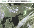
Noaa19 16:00




- My Satellite Setup
- A little less analogue, and a lot more crap.
- My Location
- UK
As long as they are not reversed, you know you are not dead and buried.
A
Archive-8
Guest
These look the correct way around, don't know what happened with the earlier ones.
Noaa18 20:14 15/07/2018
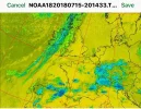


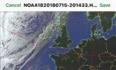

Noaa18 20:14 15/07/2018
- My Satellite Setup
- A little less analogue, and a lot more crap.
- My Location
- UK
Coordinate Frames
In case anyone is remotely interested as to why north is considered uppermost on maps and charts, even at Uranus.
In case anyone is remotely interested as to why north is considered uppermost on maps and charts, even at Uranus.
A
Archive-8
Guest
Noaa 18 10:11 16/07/18


A
Archive-8
Guest
Noaa 19 20/07/2018 16:43


- My Satellite Setup
- TM 5402HD
Sky+ UK.
- My Location
- Scottish Borders
About time I joined in again after being away in the Isle Of Man for 2 weeks. Here is the 1810 pass of NOAA 15 this evening 

pontiend
Contibruter
- My Satellite Setup
- See Signature
- My Location
- south yorkshire


- My Satellite Setup
- TM 5402HD
Sky+ UK.
- My Location
- Scottish Borders
Nice swirl in the vortex here. Noaa18 1859utc

- My Satellite Setup
- TM 5402HD
Sky+ UK.
- My Location
- Scottish Borders
I am not doing much lately.This is outdoor weather.I did get that one though.I notice that You get father north and south than me.Perhaps the elevation was higher at your end.
NOAA 15 Northbound 66W MEL 6 W LONG 18:12 UTC
Apart from a hill out to the SE which knackers the low angle passes in that quadrant its virtually flat round here. I can see right down to about 2.5 degrees elevation above the horizon in most directions.


pontiend
Contibruter
- My Satellite Setup
- See Signature
- My Location
- south yorkshire
I another thread I have been complaining about a lot of poor scans recently.
I have been getting some very good ones from East passes 14-21.There must be a gap in the houses thereThe last three good ones are from NOAA 18.the latest Still only mcir precip saved
NOAA 18 20E MEL 21 E LONG. 17:41.

I have been getting some very good ones from East passes 14-21.There must be a gap in the houses there
The last three good ones are from NOAA 18.the latest Still only mcir precip savedNOAA 18 20E MEL 21 E LONG. 17:41.
